Choosing a Hayward Lake: What Each One Is Like to Own
November 19, 2026
November 19, 2026
In September 2026, Sawyer County recorded 27 home sales, down from 46 in September 2025. The median price fell to $340,000 from $392,500, according to the Wisconsin REALTORS Association's September 2026 report. With 27 sales, the median moves with whichever properties happened to close that month. A few cabins on a small lake one month and a few homes on a deep, clear lake the next can swing it by tens of thousands of dollars, even if nothing changed for any single property. If you've settled on the Hayward area and are deciding which lake, the county figure tells you how fast the market is moving. It tells you very little about the lake you're choosing.
The big lakes around Hayward are different things to own. Three are natural lakes, and two are flowages held up by a dam. Depth runs from a 34-foot average on Lac Courte Oreilles to 11 feet on Nelson. On the Chippewa Flowage, private owners hold only a small share of the shoreline.
The same September 2026 report put Sawyer County at 7.8 months of inventory and an average of 163 days on market, up from 97 days in September 2025. Other counties in the WRA's North region ranged widely that month. Washburn's median was $380,000, Oneida's $455,000 and Vilas's $520,000.
The Wisconsin Department of Revenue's 2026 equalized values show where Sawyer County's property value actually sits. The City of Hayward is listed at $415.6 million. The surrounding towns are listed at much larger figures: the Town of Hayward at $1.197 billion, Bass Lake at $1.051 billion, Round Lake at $812 million, Spider Lake at $613 million, Lenroot at $559 million and Hunter at $470 million, per the DOR's 2026 report. Equalized value is an assessment figure, not a sale price. Still, the pattern is clear: most of the county's value is out in the lake towns, not in the city. That's why the choice of lake comes first.
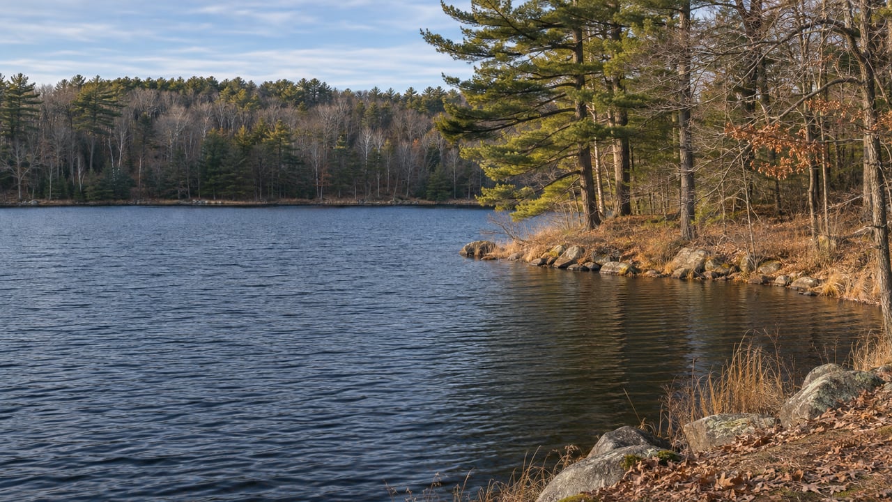
Lac Courte Oreilles is the big one in this group. The Wisconsin DNR classifies it as a natural drainage lake of 5,139 acres, 90 feet at its deepest with a 34-foot mean depth. It is oligotrophic, and the DNR calls its water "very clear." The DNR lists northern pike as abundant and musky and walleye as common, along with both bass species and panfish. Its invasive species list includes Eurasian water-milfoil, curly-leaf pondweed, rusty crayfish, and banded and Chinese mystery snails. Four groups manage the lake together: the Courte Oreilles Lakes Association, the LCO Conservation Department, the DNR and Sawyer County. COLA's 2021 to 2025 aquatic plant management plan sets goals to control existing invasives, prevent new ones, protect native plants and educate people who use the lake.
Round Lake, often called Big Round, is a different type of natural lake. The DNR classifies it as a 3,294-acre seepage lake. It reaches 74 feet, averages 33 feet deep and has a mostly sandy bottom. The DNR classifies it as oligotrophic, with a recent five-year average summer trophic state of 32 based on Secchi disk readings. Its invasive species list includes Eurasian water-milfoil, hybrid Eurasian/northern water-milfoil, flowering rush, rusty crayfish and banded mystery snail. The Round Lake Property Owners Association dates to 1963.
Grindstone Lake is another natural drainage lake. It covers 3,176 acres, reaches 60 feet and averages 30 feet deep, over a mostly sand, gravel and rock bottom. It is more of a walleye lake. The DNR lists walleye as abundant and musky, smallmouth and northern pike as common. Its invasive species list is shorter: banded mystery snail, curly-leaf pondweed and rusty crayfish. The Grindstone Lake Association was founded in 1994.
None of the three is held up by a dam. A buyer comparing these lakes is mostly weighing depth, bottom type, fishery and how much invasive species work the lake needs.
Flowages work differently. Nelson Lake is a 2,716-acre flowage by the DNR's count. It is 33 feet at its deepest but only 11 feet on average. The DNR lists its trophic status as eutrophic, and it lists walleye as abundant. Its overview page lists the water clarity as low. The Nelson Lake Association describes 31 miles of shoreline and 16 islands, and says the flowage was created by a dam completed in 1937. In 2020, the Sawyer County Record reported that the county owns that dam and had approved a four-foot fall drawdown for walleye spawning and work on the dam and landing.
The association's October 5, 2026 board minutes show what owners there are working on. The board had a long discussion about keeping wake surfing off Nelson Lake, after many residents noticed algae blooms that lasted longer and covered more water last summer. It voted to look at other local lakes' signage and recommend signs for Nelson with educational information on wake-enhanced activities. The board also approved $7,500 for walleye stocking in 2027, the last year of the cycle the association pays for. It submitted a Clean Boats, Clean Waters grant application and assigned a volunteer to run a boat landing monitoring program. Its winter schedule includes Winter Rama on January 16, 2027, and a fishing event on February 13. On a shallow walleye flowage, owners pay for stocking, staff the landings and organize the events themselves. Those volunteer hours come with the property.
The Chippewa Flowage is the largest lake in the group by far, at about 15,300 acres according to the DNR's 2025 brochure. The brochure counts about 200 undeveloped islands and 233 miles of shoreline. The state owns about 50% of that shoreline, the tribe about 30% and the national forest about 12%. Private owners hold roughly 8%. That small private share is the main fact for a buyer. Most of what you see from a Chippewa dock will stay undeveloped, and the supply of private frontage is small and won't grow.
The DNR describes the flowage as a well-known musky fishery, with walleye especially tied to the east side and connecting rivers. It also lists sturgeon and catfish. Xcel Energy owns and maintains the dam, and the Lac Courte Oreilles Band operates the hydroelectric facility. Water levels are decided one year at a time. In September 2024, Xcel announced there would be no habitat-based drawdown that fall and returned to its historical fall refill and winter drawdown. A year later, in October 2025, Xcel announced a modified habitat-based drawdown, recommended by a partners group that includes the DNR, the U.S. Forest Service, property owner and resort associations, the LCO Band, the Wisconsin Conservation Congress and Xcel. The plan was to reduce Eurasian water-milfoil and improve fish habitat. It targeted about 1,309 feet by mid-November and about 1,305 feet by early March, with spring refill depending on rain and inflows. Xcel told owners to remove boats and docks as needed and said some landings could be harder to reach.
The Chippewa Flowage Area Property Owners Association's Summer 2026 newsletter reported that a recent full-lake plant survey found an increase in Eurasian watermilfoil, which it called "concerning, but nothing like many of our neighboring lakes." The association splits the shoreline into 36 sections. In its Adopt-A-Shoreline program, now in its 20th year, volunteers hand-cut purple loosestrife flowerheads. The work filled 24.5 bags in 2023, down from hundreds in the program's early years, and the LCO Conservation Department has adopted three sections.
| Lake | Type | Acres | Max / mean depth | DNR clarity or trophic status |
|---|---|---|---|---|
| Lac Courte Oreilles | Natural drainage | 5,139 | 90 / 34 ft | Very clear, oligotrophic |
| Round Lake | Natural seepage | 3,294 | 74 / 33 ft | Oligotrophic |
| Grindstone Lake | Natural drainage | 3,176 | 60 / 30 ft | Not listed |
| Nelson Lake | Flowage, county dam | 2,716 | 33 / 11 ft | Low clarity, eutrophic |
| Chippewa Flowage | Flowage, Xcel dam | about 15,300 | 92 ft max | Not listed |
Does the Sawyer County median tell me what lake frontage costs? No. It's a single county-wide figure built on 27 sales in September 2026, so it says little about any particular lake. The September 2026 figure of 163 average days on market is more useful, because it suggests buyers in this market have time to compare.
Which lakes have water levels set by a dam? Nelson Lake and the Chippewa Flowage. The county owns the Nelson dam, and Xcel owns the Chippewa dam.
Who looks after each lake? Each one has an owners' group: COLA on Lac Courte Oreilles, the Round Lake Property Owners Association, the Grindstone Lake Association, the Nelson Lake Association and CFAPOA on the Chippewa. Reading a group's minutes or newsletter is a good way to see what owning on that lake involves.
At United Country Real Estate | Northern Wisconsin Lifestyle Properties, we look at a Hayward lake property starting with the water: the depth off the dock, whether a dam sets the level, how much of the far shore will stay wild, and what the lake association is working on this year. If you're weighing Lac Courte Oreilles against Round, or a Nelson cabin against Chippewa frontage, Schedule a Consultation and we'll go through the lakes on your list with you, one by one.
Stay up to date on the latest real estate trends.
Wisconsin USDA Loans
Wisconsin Land Maintenance
Wisconsin Hunting Land Value
Wisconsin Property Taxes
Elevate your property selling journey by working with Matt & Brittany Schultz, bringing decades of hands-on land, waterfront, and financing experience to help you maximize your property's value.
United Country Real Estate
1133 4th Ave S, PO Box 434 Park Falls, WI 54552